Saturday, January 10, 2015
Friday, December 27, 2013
Tuesday, July 16, 2013
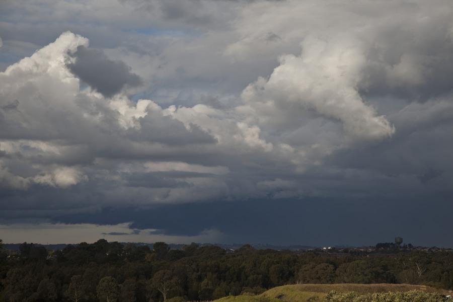
Flash flooding from Winter Storms in Sydney 16th July 2013
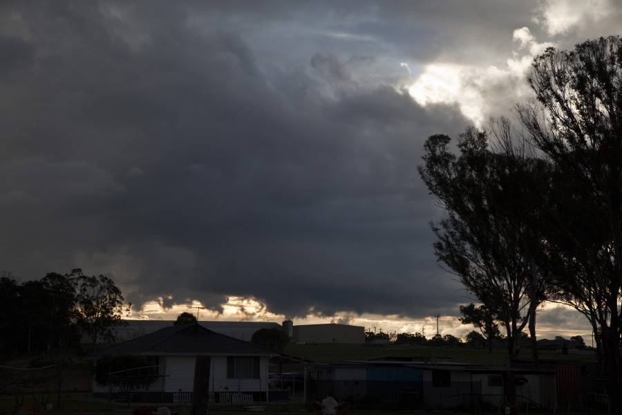
Storms western Sydney 16th July 2013
Flash flooding at North Ryde with this storm
 A storm produced flash flooding as 15mm fell in 15 minutes at North Ryde! It is unusual for storms to occur during winter so this storm cell was a surprise particularly its intensity! The storm was spawned near the Riverstone Schofields corridor and intensified as it moved over Baulkham Hills Castle Hill district finally dumping torrential rain over the North Ryde area. The storm then drifted east and gradually weakened. A boy was swept into a creek or river at the height of the storm.
- Storm weakens rapidly near sunset
Flash flooding from Winter Storms in Sydney 16th July 2013
Friday, June 28, 2013
Developing East Coast Low

A strong upper trough will move into the region Sunday and help deepen in an existing surface trough along the coast. An East Coast Low is likely to form near the SE QLD coastline. The forecast position and intensity of this low varies between the weather models but the most likely outcome at this stage is for the Gold Coast, Northern Rivers and northern parts of the Mid North Coast to cop the worst of it – especially during Monday. Strong to gale force wind gusts may also develop along the coastal strip. Some locations may see falls of 150-200mm over 48 hours – though this looks much more likely for coastal areas.
Thunderstorms are possible in the mix as instability is present both Sunday and Monday – expect heavy rainfalls if you’re under one of those.
Rain areas and showers should persist into Tuesday clearing from the north with Wednesday fining up. Then several days of clear skies are expected.
Attached is the rainfall forecast map from the BoM for Monday.
Developing East Coast Low
Tuesday, June 25, 2013
Snow NSW Northern Tablelands 25 June 2013
Approx 2cm of snow fell in the Black Mountain area and 1cm in Guyra between 4 and 5.30am 25 June.
Further wet snow and sleet fell across the region during the morning but it did not accumulate further. 850 hPa temps needed to be 1 C lower for a better cover.
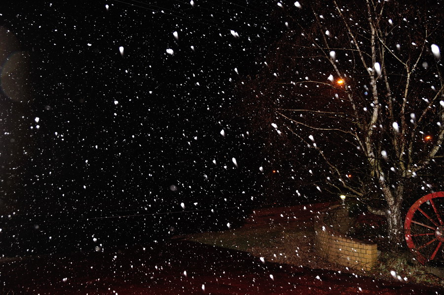
Snow NSW Northern Tablelands 25 June 2013
Friday, June 21, 2013
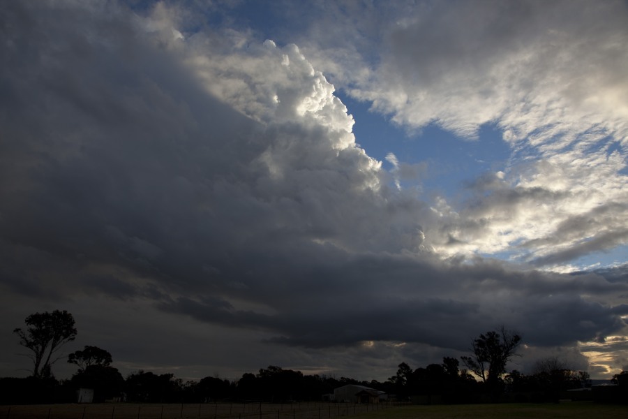
Extreme Lightning El Reno Tornadic Supercell 31st May 2013
Some crazy lightning was observed on this tornadic developing supercell. It was so intense we remained in the vehicle during the barrage – and as you note in the video, I took the aerial into the car! I understand that the probability was low but chaser vehicles have been struck in the past!
Extreme Lightning El Reno Tornadic Supercell 31st May 2013
Thursday, June 20, 2013
Flood Watch for parts of NSW

A large part of the NSW coast is on flood watch with an east Coast Low expected to develop during Monday. Models are not consistent with the timing or placement of a possible low, or ever whether heavy rainfall will push inland much. However the BoM have issued a flood watch
FLOOD WATCH FOR MINOR TO MODERATE FLOODING ON THE PATERSON, WILLIAMS, WYONG, NEPEAN, GEORGES AND THE TIDAL ZONES OF THE COOKS AND WORONORA VALLEYS.
Issued at 12:45 pm EST on Friday 21 June 2013
Note: This Flood Watch is a “heads up” for possible future flooding along all rivers and creeks within a nominated valley and is NOT a Flood Warning [see note below].
From late Saturday night (22/6/13) through to Monday night, heavy rain is expected over coastal districts between Narooma and Seal Rocks. This rain is likely to cause local and main river flooding.
At this stage there is a greater than 70% chance of flooding along the following river valleys:-
Paterson and Williams Valleys – minor to moderate flooding
Wyong Valley – minor flooding
Georges River Valley – minor flooding
Nepean River Valley – minor to moderate flooding
Heavy rain combined with King Tides over the same periods may also expose the tidal zones of the Cooks and the Woronora Rivers to minor flooding.
This Flood Watch means that people living or working along rivers and creeks must monitor the latest weather forecasts and warnings and be ready to move to higher ground should flooding develop. Flood Warnings will be issued if Minor Flood Level is expected to be exceeded at key sites along the main rivers for which the Bureau of Meteorology provides a flood warning service. Across NSW about 75% of Flood Watches are followed by flooding within the catchment.
FloodSafe advice is available at www.ses.nsw.gov.au
For emergency assistance call the SES on telephone number 132 500.
For life threatening emergencies, call 000 immediately.
Flood Watch for parts of NSW